


Ongoing since the late 1800s, with numerous small-scale geophysical surveys (i.e., magnetics, self-potential, (IP), geochemical surveys, and drill programs being conducted, primarily focused on and proximal to the historic workings.

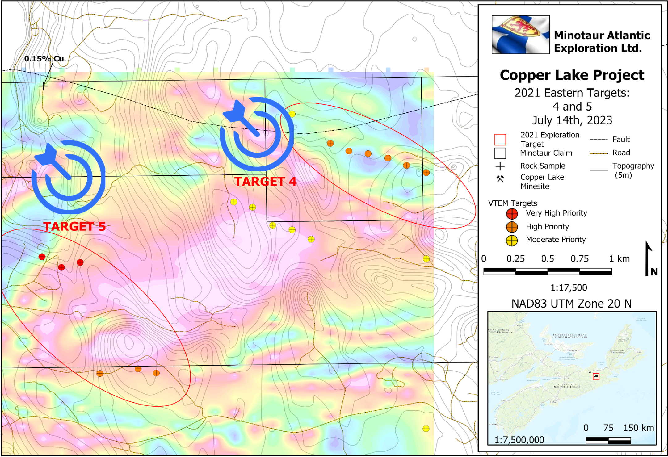
Proprietary modelling identified five high-priority conductivity anomalies that warranted further investigation.

Minotaur Exploration Limited (Australia) identified the crustal-scale, Cobequid – Chedabucto fault system and associated Fe-Oxide deposits as part of an IOCG Style System.

An extensive regional gravity survey identified Copper Lake as a priority target for detailed follow-up. Geotech Ltd. conducted an airborne VTEM and magnetic survey over the entire Copper Lake property.


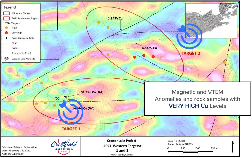
Copper exploration has been successful in defining 3 priority targets with an IOCG affinity along a 4 – 5 km corridor extending from the SW corner of the Minotaur Claims to the NE, through the Copper Lake mine site and terminating near Loch Katrine.
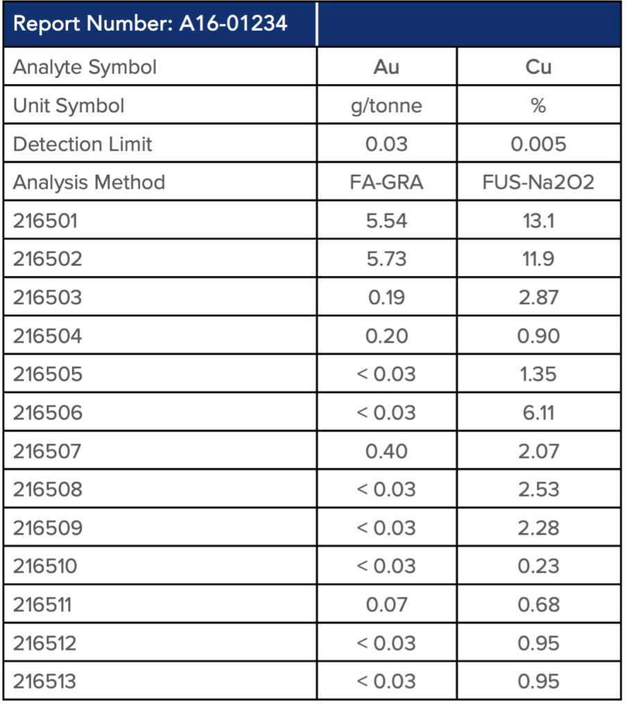
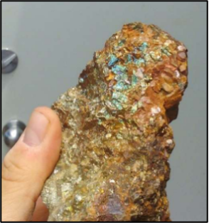
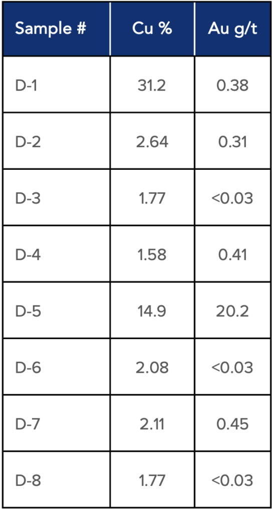
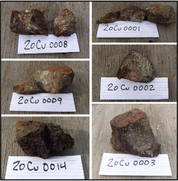
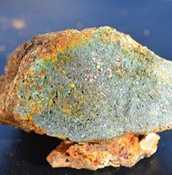
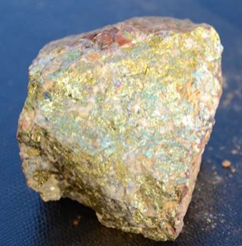
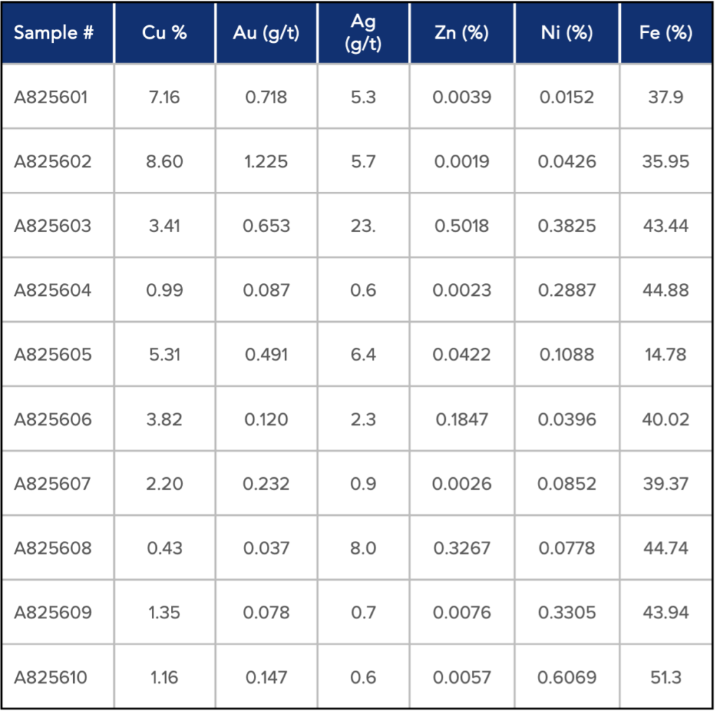
Copper assays at the historic site generally range from 1- 5% with local, high-grade exceptions accompanied by gold (0.1 to 20.2 g/t) with the target open at depth and along strike. Silver and zinc are also anomalous, the latter peripheral to the main copper signature and related to a black argillite.

Historic pits have been located within the Cu soil anomaly. These are NOT related to the historic workings and require further investigation. Structural controls are apparent with mineralization and geophysical targets (VTEM) occurring along or proximal to splays directly related to the main northeast-trending fault in the western portion of the claim group.

Corridor is flanked to the NW and SE by gravity highs and defined by a distinct topographic break that is further accentuated by the ground magnetics. Within the corridor, a well-defined copper target is adjacent to the historic workings and overlies a defined gravity high.

Ongoing since the late 1800s, with numerous small-scale geophysical surveys (i.e., magnetics, self-potential, (IP), geochemical surveys, and drill programs being conducted, primarily focused on and proximal to the historic workings.
Proprietary modelling identified five high-priority conductivity anomalies that warranted further investigation.
Minotaur Exploration Limited (Australia) identified the crustal-scale, Cobequid – Chedabucto fault system and associated Fe-Oxide deposits as part of an IOCG Style System.
An extensive regional gravity survey identified Copper Lake as a priority target for detailed follow-up. Geotech Ltd. conducted an airborne VTEM and magnetic survey over the entire Copper Lake property.
Copper exploration has been successful in defining 3 priority targets with an IOCG affinity along a 4 – 5 km corridor extending from the SW corner of the Minotaur Claims to the NE, through the Copper Lake mine site and terminating near Loch Katrine.
Copper assays at the historic site generally range from 1- 5% with local, high-grade exceptions accompanied by gold (0.1 to 20.2 g/t) with the target open at depth and along strike. Silver and zinc are also anomalous, the latter peripheral to the main copper signature and related to a black argillite.
Historic pits have been located within the Cu soil anomaly. These are NOT related to the historic workings and require further investigation. Structural controls are apparent with mineralization and geophysical targets (VTEM) occurring along or proximal to splays directly related to the main northeast-trending fault in the western portion of the claim group.
Corridor is flanked to the NW and SE by gravity highs and defined by a distinct topographic break that is further accentuated by the ground magnetics. Within the corridor, a well-defined copper target is adjacent to the historic workings and overlies a defined gravity high.